
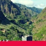


A guide to the best hikes in Santo Antao, Cape Verde, the trails, and where to go hiking.
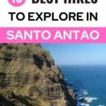
Santo Antão, the second-largest island of the Cape Verdean archipelago, is a paradise for hikers and trekkers.
It offers breathtaking views, monumental valleys, houses built on almost vertical valley sides, and vertiginous Cape Verde trekking trails. All of this is surrounded by intact nature and agriculture.
The trails are well-maintained and often used daily by locals. Don’t be surprised when a granny carrying a big basket full of vegetables will overtake you on your trek.
Most trails connect several villages and are well-indicated when you travel Cape Verde.
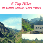
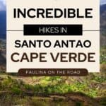
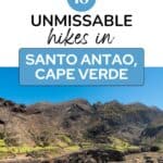
Here is my selection of top hikes in Santo Antao! The number of hikes you can do on Santo Antão seems infinite. After staying more than 1 month, I’ve only seen half of the island and still some trails I would like to explore.

You, dear reader, support this blog. When you purchase through a link, I may earn a small commission. As an Amazon Affiliate, I earn from qualifying purchases.
Pssst…??!! You can’t get enough of Cape Verde? Have a look at my other posts:
Table of Contents
Top Resources to Travel Santo Antao & Sao Vicente
⚘ Don’t leave without a travel guide. Be prepared and get the Sao Vicente & Santo Antao Guide
✈ Book cheap flights to Cape Verde with Skyscanner
✔ Book the best tours in Cape Verde with GetYourGuide
➳ Find the best hotel deals in Cape Verde with Trivago
❖ Get the best car rental deals with DiscoverCars
☘ Get the best discounted outdoor gear (outlet) at REI.com
✎ Never leave without travel insurance. I get mine at HeyMondo. It’s easy to set up, cheap, and reliable.
✔ Skip the queue at the airport and get your Cape Verde visa in advance with iVisa
$ Withdraw money without hidden fees and avoid rubbish exchange rates with Wise (You’ll get a card for free!)
Top Hikes in Santo Antao
- Ribeira Grande – Fontainhas
- Monetrigo de Tarrafal – Beach
- Ponta do Sol – Chã de Igreja
1. Valle de Paúl: Cova – Cidade das Pombas
Difficulty: Medium
Duration: 6 hours
Where to Stay: Casa Cavoquinho

If, for whatever reason, you choose to do only 1 hike on Santo Antão, then Valle de Paúl is the one! The trail leads you from the Cova crater through the fertile Valle de Paúl to Cidade das Pombas.
Get to Cova early in the morning by aluguer (4 €, departing from Ribeira Grande). Only the views on the neighboring island of São Vicente are worth stepping in for a bite.
The Cova crater is about 10 minutes away and at the beginning, you’ll be in the company of some milk cows. The trail leads you out of the lush green crater.
This is the only ascending inclination of the entire hike, just until you reach the crater’s edge. From here, you’ll have the best and the most breathtaking view ever!
The immense Paúl valley is at your feet and you can already spot Cidade das Pombas next to the sea.
Now, the dizzying part of the hike begins. This part of the trail is really not meant for those who are afraid of heights because it goes down steeply.
The trail ends at a larger paved road that leads you through picturesque farmer villages until you reach Pombas.
On your way, you’ll pass along coffee plants, mango and avocado trees, countless banana plants, and coco palms. Most of the island’s fruit and vegetable exports come from this valley.
It is particularly fertile due to its micro-climate.

As a short stopover, I recommend O Curral in Cha de João Vaz. The place is owned by an Austrian couple producing their own grogue (sugar cane brandies) and food with ingredients grown in their garden.
While you enjoy a local fruit salad with natural yogurt, you can watch the workers prepare the ingredients for the day’s lunch.
Although the place is a bit pricey, with every bite, you’ll taste their freshness and “savoir-faire”.
When you keep walking on, you’ll be surrounded by papaya and passion fruit trees. The only direction is downwards, it’s impossible to get lost.
For those who want to fill up their minibar at home, visit the grogue factory in Cidade das Pombas.
If you are looking for a good lunch option in Cidade das Pombas, I recommend Casa Maracuja. The restaurant is located on a rooftop with gorgeous views of the valley and Cabo Verde Cuisine.
Many of their meals are based on passion fruit. You have to try the self-made passion fruit ponche! It’s delicious!
I loved the restaurant’s interior design, which used passion fruit plants to cover the terrace and the chill-out area. All the furniture is “passion fruit-yellow.”
But the heart and soul of this place is Hetty, a cheerful woman who seems to speak any language.
After the descent in Paúl Valley, I felt pain in my knees for several days. It’s really a strong descent for several hours.
But this trail is definitely worth it! In Cidade das Pombas you get aluguers to any other larger village on the island.
Hiking in Cape Verde can be dangerous, as there are no hospitals nearby. That’s why I recommend getting Cape Verde travel insurance before visiting.
I got mine with HeyMondo. It is super easy to set up and cheap too!

2. Ponta do Sol – Chã de Igreja
Difficulty: Medium (very long)
Duration: 6 to 7 hours
Where to Stay: kasa Tambla

This hike is one of the most popular ones on the island. It goes along the Northeastern coast and passes through villages with no access to paved roads.
The views from the valleys and cliffs are some of the most impressive on the island.
This hike is medium/difficult. It doesn’t have a lot of increase, but it is quite long. The trail is damaged in some parts due to the last rainy season.
Be prepared that it will be hard to find an aluguer in Chã de Igreja.
You may organize your transport in advance, or you can take a taxi from Chã de Igreja back to your hotel.
With some fellow hikers that I met on the trail, I got organized and shared the costs of a taxi. Many hikers pass the night in Chã de Igreja.
The trail starts in Ponta do Sol, the most touristy village of Santo Antão and a stronghold of French emigrants.
The path leads you along the graveyard and pigsties.
After 1 hour, you reach Fontainhas, Cape Verde’s most picturesque village. After descending sharp serpentines, you reach Corvo. Here, you have a bar if you want to refresh.
I continued on the trail to Formiguinhas (“little ants”). On my way, I met cobblestone producers and youngsters accompanied by their fully charged donkeys.

I reached Forminguinhas and it was the perfect place to have lunch. You have the choice between Sonia’s and Isabel’s bar.
Sonia’s bar serves lunch (better reserved in advance) and offers very spare rooms for those who don’t want to continue until Cha de Igreja.
Sonia cooks traditional basic Cape Verdean food and is such a friendly lady. I just didn’t want to leave!
Calculate 2 to 3 hours from Formiguinhas to Cha de Igreja. From Formiguinhas, you’ll have no rest points until Cruzinha (2 hours walk). Make sure to carry enough water or stock up in Formiguinhas.
The trail leads to the Aranhas valley, which is sometimes dazzlingly high. By now, it has been abandoned and serves as a pasture for the herds of the surrounding villages.
The house ruins give the landscape a very particular atmosphere. The lush green color of the Aranha Valley contrasted with the rocky coasts I had seen so far.
On the way to Cruzinha, the next village, you’ll walk along several beaches. Although a bath looks pretty tempting, you shouldn’t even set foot on it!
Tights and drifts are extremely strong and easily underestimated! Every year, tourists become victims of the sea because they don’t want to renounce a refreshing bath!
After 1 hour, I reached Cruzinha, a small fishermen’s village with breathtaking views of the coast and the ocean.
Cruzinha has a few accommodation options as well. Just before you reach Cruzinha, drivers already await you at the end of the trail to offer you their taxi services.
Don’t hesitate to negotiate the price with them in case you don’t want to continue walking until Cha de Igreja.
Cha de Igreja is set in a fertile valley, and it felt so good to be back among civilization after six hours of hiking. The center of the village is very well maintained and has many lovely photo opportunities.
I loved the relaxing atmosphere of this place. From Cha de Igreja, I got back by aluguer to Ribeira Grande (25 €).
Don’t hesitate to ask the driver to stop during the ride since the valley of Cha de Igreja offers some spectacular views.
Check here the prices on guided hikes in Santo Antao

3. Ribeira Grande – Fontainhas
Difficulty: Easy
Duration: 3 hours
Where to Stay: Sissi’s B&B

Since I was based in Ribeira Grande, I wanted to do a hike without public transportation.
Ribeira Grande is one of the larger villages of Santo Antão and is a great starting point to discover the island. It’s not as touristy as Ponta do Sol.
Aluguers are easy to take and the town has several good restaurant options.
A part of this hike is on the asphalted road connecting Ribeira Grande to Ponta do Sol, offering trekking Santo Antao enthusiasts stunning views of the rocky coast and valleys.
Before reaching Ponta do Sol (1 hour and 30 minutes from Ribeira Grande), you pass a poor settlement of tile makers.
As I was approaching, kids ran to me, asking for pencils.
Unfortunately, I didn’t have any, but I promised myself to get some at the next village. That’s how I ended up buying 20 pencils in Ponta do Sol and handed them out on my way home to Ribeira Grande.
I’ve never seen happier kids, and I could hear their jolly shouting even after leaving the settlement.
In many more villages that I hiked through, kids approached me asking for pencils. Since then, I have always carried pencils in my backpack.
For those who want to recover a bit in Ponta do Sol, I recommend Residencial Sinanton Trekking.
Using the same trail as at the beginning of the hike from Ponta do Sol to Chã de Igreja, the path goes along the graveyard.
After 1 hour and 30 minutes, you reach Fontainhas Santo Antao. Due to its unique setting in the mountains above a fertile valley, Fontainhas is a very popular postcard motive.

For many, it’s Cape Verde’s most picturesque village. If you want to visit only one village in Santo Antão, go to Fontainhas.
The houses are impressively enthroned on the giant cliff, and during the rainy season, the waterfalls make the setting even more dramatic.
I loved to soak up its particularly calm atmosphere. The colorful house fronts, people working on their fields in breathtaking heights, now and then a cock crow and the distant sound of the waves, etc.
The best place to forget about time is Bar Tchú. The owner makes this a uniquely welcoming place. With his big smile, you’ll feel at home from the moment you step in.
Tchú usually serves one daily menu made with ingredients from the surrounding gardens.
I also recommend his self-made fruit juices. Every other ingredient that doesn’t grow in the fertile valley, he gets it from Ribeira Grande.
Consequently, several days a week, he walks all the way to Ribeira Grande to get the beers and soft drinks he serves in his bar. At (too) cheap prices.
With a heavy heart, I said goodbye to Tchú and hiked back home like I came from Ribeira Grande.

4. Corda – Coculi
Difficulty: Difficult
Duration: 6 to 7 hours
Where to Stay: Casa Pedrina

I chose this trail upon the recommendation of a Swiss hiker I met in my hostel. Although this is a very tough one, I never regretted my choice to hike from Corda to Coculi.
The views of unsettled valleys and the blue ocean as a background will leave you speechless for several moments.
The trail leads you through villages that are not used to see tourists. On the fields, you see the authentic Cape Verdean life of Santo Antão.
Get an aluguer to Corda (departing from Ribeira Grande). The trail starts at the school of Corda, whose inhabitants are glad to show you the directions.

Following the trail, you walk along the fields of intensive terrace cultivation and small wooden huts. You see plenty of guayabas, papaya, and breadfruit trees.
Following the beaten track, you’ll suddenly be in front of a gorgeous panorama view of a lush green valley.
The trail goes along a wall and it’s definitely nothing for those who are afraid of heights. Soon, you’ll catch sight of Coculi, down in the valley.
But it is still a very long and steely way down. The path descends in sharp serpentines, and after 2 to 3 hours, I finally reached my first village: Figueira. This place is full of sugar cane and papaya trees.
It’s one of the remotest places I’ve been. There’s just one little shop selling water and fruit juices.
I was impressed by the terrace cultivation and how people were not afraid to cultivate their fields or carry heavy baskets at dizzying heights. Finally, I got on a paved road again!

Here, I met an 82-year-old lady who told me that in her youth, she did the trail to Corda (ascending!) in 1 to 2 hours. I needed 3 to 4 hours to descend! In her flip-flops, she overtook me, laughing out loud.
It got strenuous but luckily, I met a lot of people during my hike. Cape Verdeans use to greet everybody (Tud drett?). When I finally reached Coculi, surrounded by a myriad of palm trees, I was starving.
The city has good infrastructure (hospitals, supermarkets, etc.). I had a delicious lunch/dinner at one of the only restaurants in town. In those places, you usually can’t choose from a menu card.
You’ll eat the “Prato do dia” (daily menu) or nothing. From Coculi, you’ll get back to Ribeira Grande by aluguer or by foot.
Corda – Coculi was definitely one of the longest hikes I had, but also one of those that marked me the most: the remote village, the sharp serpentines, plenty of fruit trees … Simply mind-blowing!
Check here the prices on guided hikes in Santo Antao


5. Ribeira Grande – Xoxo
Difficulty: Easy
Duration: 3 hours
Where to Stay: Casa Xoxo

If you’re looking for a short hike with great views in a short distance from Ribeira Grande, then Xoxo village might be the right one for you.
Although, my main reason for this hike was the funny name of the village.
By aluguer, I got to Xoxo. It’s set on a slope, and the trail through the village takes about 1 to 2 hours to reach the top.

Xoxo preserved its authentic charm, and again, I was impressed by the older ladies who carried their heavy baskets on their heads or children carrying gas bottles.
Obviously, the people of Santo Antão are used to steep hillsides, whereas we foreigners are just watching them out of breath.
From the top of Xoxo village, you have a fantastic view of the valley of Ribeira Grande. The trail goes further upwards, but I decided to go back instead.
My feet were just hurting too much from my previous hikes.
On the way back, on the right, just after leaving Xoxo, you pass close to a gorgeous waterfall. During the dry season, the waterfall might be dried out.

If you walk for half an hour more, you’ll finish in front of a lovely tiny restaurant whose terrace has a stunning view of the mountains surrounding Xoxo.
Again, there are no menu options. You’ll have one “prato do dia” (daily menu). It was incredibly delicious and cheap. And again, I was overwhelmed by the kindness of the people of Santo Antao.
In case you want to enjoy the gorgeous surroundings of Xoxo for a longer time, I recommend a stay in the lovely country house Casa Xoxo.

Before leaving, you can swim in the natural swimming pools in front of the Melicia restaurant.
Alternatively, From the center of Xoxo, it’s still about one hour to get back to Ribeira Grande, which I did by hitchhiking. My feet were hurting me too much.

6. Ribeira Grande – Sinagoga
Difficulty: Easy
Duration: 2 hours
Where to stay: Casa das Ilhas

Santo Antão is not mainly known for its beaches. The tides are very strong, and the waves are often very high.
You’ll always be surrounded by the sea, but you can’t swim in it.
Despite the hot temperatures, I was more than happy to hear about the natural swimming pools in Sinagoga.
As usual, you get there by aluguer, or you can walk along the road connecting Cidade das Pombas with Ribeira Grande.
In Sinagoga, there are a few bars and a mercearia (little shop) where you can stock up on water and snacks.
The village’s name comes from the Jewish community that was expelled from Portugal and found a new home in Santo Antão. Nowadays, you can still see the impressive ruins of a former hospital.

After the Jewish community extinguished, the building was used as a sanatorium to take care of the leprosy patients. Despite its macabre historical background, the ruins are a great photo motive.
The natural swimming pools are a bit hard to find. When you come from Ribeira Grande, you turn left after a huge rock, following the sign “Beach Bar”, before you even enter the village.
If you can’t find the path, ask the locals. They’ll be happy to help you out.
The path leads you down towards the ruins of the synagogue and the swimming pools.
Read here about the best beaches in Cape Verde

If you continue on the same path, you will reach a large beach that is very popular among (experienced!) surfers. Be careful! Here as well, the tides are very strong and will swallow you!
That is why I got into the water until my hips and contented myself by watching the surfers.
Nevertheless, the views of the cliffs were impressive, and the sunset was just amazing. In all, Sinagoga is the perfect place for a “take-it-easy” day.
A restaurant, Oasis, has opened in Sinagoga. The octopus is a delight, and Oasis boasts gorgeous views over the ocean. It’s certainly a place to stay longer!
Check here the prices on guided hikes in Santo Antao

7. Monetrigo de Tarrafal Beach
Difficulty: Easy
Duration: Varies
Where to stay: Casa Praia Tarrafal de Monte Trigo

Tarrafal, nestled on the northwest coast of Santo Antao, offers a unique and secluded escape for adventurous travelers.
Thanks to the inauguration of a new street in 2021, accessing Tar-rafal from Porto Novo has become much easier, reducing travel time from four hours to just one.
To arrange transportation, contact Edson Lima (edson-dal@live.com.pt), who can organize private transportation for you.
Practical Tips for Your Visit
- Transportation: Plan your journey carefully, as there’s only one colectivo departing from Tarrafal to Porto Novo at 6 AM.
- Cash: There are no ATMs in Tarrafal, so be sure to bring enough cash for your stay.
- Dining: Experience the local cuisine at Zenilda, Mimando, or Ami-zade Delgado, known for its delicious lobster dishes.
Things to See and Do
- Beach Strolls: Take leisurely walks along the vast beaches of Tarrafal, enjoying the serenity and beauty of the coastline.
- Grogue Factory Visit: Explore the local grogue factory to learn about the traditional process of making this iconic Cape Verdean spirit.
- Montrigo Hike: Embark on a scenic hike to Montrigo, a charming village nestled in the mountains. Organize a boat transfer in advance or join fellow hikers along the trail. The cost of a boat ride back from Montrigo to Tarrafal is approximately 45€ per person, which can be split among travelers. Despite its remoteness, the village boasts a cozy mercearia (grocery store) and a place to sleep.
- Remote Retreat: Tarrafal offers a glimpse into the quieter side of Santo Antao, with its small population.
Tarrafal offers a glimpse into the quieter side of Santo Antao, with its small population. I recommend spending at least two nights there.
However, keep in mind that resources are limited in Tarrafal, so plan accordingly for a truly off-the-grid adventure.
The beaches in the Tarrafal area are the only ones that can be used without any worries.
But still, here, be aware! The Atlantic Ocean is very powerful! The beaches of Tarrafal have black sand and are several hundred meters long. It’s magical indeed and perfect for hiking Santo Antao.
The route from Porto Novo to Tarrafal takes approximately 1 hour by car. First, it is on an asphalt road, then a cobbled lane, and finally, a dirt track.
From here, you can start hiking. This is the most beautiful part of the route, where you can admire a breathtaking landscape. Along the road, you’ll probably meet some shepherds with their goat herds.
Thanks to the abundant spring water, many fruits and vegetables can be cultivated: mango, banana, papaya, bread-fruit, sugar cane, yam, manioc, maize, beans, etc.
It is a perfect place for trekking, swimming, snorkeling, fishing, and unwinding.
This hike is considered one of the least known in Santo Antao, so it’s perfect for those who want to gain a privileged insight into the Cape Verdean daily grind.
Read here on Island Hopping in Cape Verde
8. Lagoa – Matinho – Caibros – Mouth of Both Streams
Difficulty: Medium
Duration: 5 hours
Where to stay: Casa Medina

Little known but of great interest, crossing sometimes desert, sometimes volcanic craters, and sometimes green streams, including high slopes.
There are three options for overnight stays in Chã de Igreja, but reservations must be made in advance.
The population is dedicated to cattle raising, dry farming, irrigation, cheese production, brandy, horticultural produce, and fruit production.
The circuit is completely the same as the RG04 until Matinho. From there, a sign indicates the direction to take.
The footpath between the slopes to Caibros is a bit difficult, so this circuit is recommended for more experienced hikers.
From Caibros, the circuit can be done on foot or by car.
Check here the prices on guided hikes in Santo Antao
9. Pico da Cruz – Péro Dias – Silvão – Ribeira de Penedo – Janela
Level: Easy
Duration: 4 hours
Where to Stay: Guest House Frontera

According to the popular saying, an Englishman, passing by this route, and thinking it was the sea, plunged back and forth into an abyss filled with flakes of white cotton clouds.
Narrow side roads open snake access through mountain ranges and small valleys, where the highest altitude is around 1,500 meters at Pico da Cruz.
I am impressed by the great altitude and the flora dominated by conifers, which make the region one of the most beautiful on the island.
The climate is under-moist, with possible precipitation during the night, so, if you do this route, you will also find a great variety of plants.
In Ribeiro de Penedo, there is a strange inscription dating from the time of the Corsarios.
The morphology of the land is reminiscent of Janela, which, according to researchers, determined the choice of the name Janela to designate the region.
A variant of the circuit would be to follow the route Lombo de Tanque, Bordeira da Fajã, Janela, and Penedo.
Janela is an area rich in fish and crustaceans. Sport fishing is possible there, but you have to reserve in advance.
10. Água das Caldeiras – Rabo Curto – Lombo de Pico – Xôxô – Ribeira da Torre – Vila da Ribeira Grande
Level: Difficult
Duration: 5 hours
Where to Stay: Casa Xoxo

When reaching the highest point of the Ribeira Grande or Porto Novo road, there is a bifurcation in the road on your left side.
There is a gate that is normally locked because it is the access area to Pedra Rachada, where communication systems are located.
At this point, the gate is bypassed and the paved road is followed.
At a certain point, there is a bypass on the left, which you must follow. Passing through the forest, you will find the beginning of the circuit.
From there, follow the footpath through the slopes to Rabo Curto. Along the circuit, you can enjoy unique landscapes.
The last part of the circuit, 6 km, can be done by car through Ribeira da Torre.
You can enjoy the beautiful landscape of the Planalto Leste (Eastern Plateau), at more than 1,200 meters of altitude, with weak and scattered human concentration.
The region’s flora varies according to altitude and humidity, with multi-colored shrub formations of pine, eucalyptus, acacia, cypress, gravel, medicinal plants, and more than a hundred endemic plant species.
Such as the gestiba sarcolemma dalotni, commonly known as alevatão, which is a greenish-yellow carpet, especially during rainy seasons, carved from the mountains throughout the circuit.
Ribeira da Torre has a high concentration of humans, and water is still flowing in the riverbed.
The population is dedicated to cultivating sugarcane, fruit trees, horticultural production, and small trade.
Check here the prices on guided hikes in Santo Antao
11. Lagoon – João Afonso
Level: Medium
Duration: 4 hours
Where to stay: Casa Xoxo

A challenge to the visitor, through mountains and small valleys, in pleasant visibility between the sky, rocks, and green spaces.
To start the circuit, you must follow the road that connects Ribeira Grande to Porto Novo, until the Esponger area, at an altitude of +/- 1,100 meters.
From there, you will travel along the dirt road that leads to Lagoa, at a distance of 1,200 meters, until you reach a large community cistern.
After this point, you follow the footpath, pass a small stream, and reach the circuit’s starting point. From this point, the circuit descends through the mountainous slopes.
The trajectory is possible on foot, on dirt tracks, and on side trails between rocks and mountains.
The circuit is pronouncedly difficult, especially during the rainy season when the route becomes complicated and sometimes even impassable.
The path is in good condition. The difficulty is more incredible from Fajã dos Bois and/or Fajã dos Cumes. The opposite route is very steep and not recommended.
During low fog, beautiful photographs of the top and valley of João Afonso and Chã de Pedras can be taken. When passing through Fajã dos Cumes, you can find brandy production mills.
Afterward, you can choose between continuing the tour on foot or taking a car to Ribeira Grande, where the restaurants and accommodation are located.
The distance between João Afonso and Ribeira Grande is about 10 km, and the route is on a dirt road that crosses valleys.
12. Ribeira Grande – Xoxo – Lombo do Pico – Melicia Bar
Level: Medium
Duration: 4 to 5 hours
Where to stay: Casa Xoxo

I did this hike in October 2020 and absolutely loved it for the absolute highlight: a stunning waterfall!
First you walk from Ribeira Grande to Xoxo (can also be done by colectivo). Once you arrive in Xoxo village, hike up, until you reach a bifurcation of the trails 202 and 203.
One of the trails goes left (coming from Xoxo) and goes to Cova. I followed the right path, which brought me up to Lombo do Pico.
From here, I went with a guide to find the waterfall.
You can ask someone in the village to take you. Please ask upfront for the price, and if they say they’d do it for free, leave at least a generous tip.
From Lombo do Pico you walk on farmer’s trails until you reach a panoramic view of the symbolic Xoxo rock.

From here, you continue your walk to the waterfall, having a good Santo Antao hiking map will help you not get lost.
It’s stunning and majestic. I didn’t make the last 100m to the waterfall as I am too afraid of heights … argh!!!
Following along the farmer trails next to fields of manioc, igname, coconut trees, almond trees, papayas, mango trees, etc.
Walk down to the Bar Melicia, famous for its calda (sugar cane juice). This hike goes up to 700m of altitude and down again.
Check here the prices on guided hikes in Santo Antao


13. Morrador – Vinha – Fajã de Cima – Chã de Mato – Corda
Level: Difficult
Duration: 3 to 5 hours
Where to stay: Casa Xoxo

This is quite a challenging hike but also one of the most spectacular ones I’ve done so far in Santo Antao.
Starting just next to Xoxo, from the Bar Melicia it takes you up to 1300m to Chã de Mato.
You’ll walk zigzagging paths along abandoned villages, others that have only 5 inhabitants left (Fajã de Cima).
You’ll be rewarded with jaw-dropping views into the dazzling depths of Xoxo Valley and Ribeira de Torre Valley. It’s merely incomprehensible how people can create agriculture in this setting.


When I arrived in Chã de Mato, I had tears in my eyes. It wasn’t an easy hike—it just went up, up, and up—but it was oh so worth it!
From Châ de Mato you follow Corda street down to Corda.
Here, make sure to stop at Cuzinha de Bento to enjoy their legendary Dutch apple tart along with a self-roasted coffee. The managing couple is the sweetest!
From here, you can walk down to Povoação (2 hours) or hitchhike a car.

14. Cidade das Pombas – Boca de Figueiral – Antenna – O Curral – Cidade das Pombas
Level: Advanced
Duration: 5 to 6 hours
Where to stay: Aldeia Jerome

This is a great hike to do if you’ve already trekked the Cova–Paul trail.
Indeed, this trail will allow you to explore Paul Valley off the beaten track and provide you with breathtaking views.
That said, you shouldn’t do the hike if you’re too afraid of heights and not without wearing proper hiking boots. I did this hike in trekking sandals and regretted not bringing my sturdy shoes.
The hike starts in Cidade das Pombas and, from here hikes up to Boca de Figueira, a small village.
From here, you follow a caminho vecinal on the left, don’t follow the main route. If in doubt, ask the locals.
From here, you’ll climb up to 700m, and the agricultural terraces will get more spectacular with every step. You’ll pass along some remote villages, often just consisting of a few houses.
There is only one direction: UP! It’s sometimes very steep, but the views are getting better and better.
Finally, you’ll reach the bar Chez Sandra, which provides a jaw-dropping 360° panorama view over Paul Valley.
It’s the best place to have fresh fruit juice. Without any doubt, it’s one of the best bar views I’ve seen in Santo Antao.
Now, the dazzling part begins, lasting about 15 minutes of walking. You’ll walk over the ridge until you reach the Antenna.
The views are truly amazing, but please be careful when walking down. It’s incredibly steep and narrow!
From here, keep walking down until you reach the main Paul Street. It’s only two minutes away to the restaurant O Curral, famous for its organic food and juices.
After fueling up, walking down to Cidade das Pombas is about time.
If you’re looking for a well-deserved refreshment, make a stop at Passagem which is almost halfway between O Curral and Cidade das Pombas.
You can choose among several swimming pools or the river to cool down. You will truly experience the joys of walking in Cape Verde islands.
Check here the prices on guided hikes in Santo Antao


15. Espongeiro – João Afonso – Coculi
Level: Easy-Moderate
Duration: 4 to 5 hours
Where to stay: Casa Pedrina

I really enjoyed this route because of 3 reasons:
- You get to take the spectacular Corda road to get up to Espongeiro
- You’ll discover sceneries of Santo Antao that are very different from Paul and other hiking hotspots
- You’ll get some of the typical, jaw-dropping views of Santo Antao
I did this hike with Edson from Lima Tours and couldn’t have been happier to have had him as a guide.
I had so many questions about life in Santo Antao, the flowers, the traditions, etc… And he answered them all!
Don’t hesitate to get him for your visit of the island, he speaks great English and so enjoyable to hike with.
First, drive up to Espongeiro (1400m) via the spectacular Corda street. From Espongeiro, you’ll make your way down through the valley.
I really enjoyed the first landscapes of this hike. The rolling hills differed from the rough valley and peaks of Paul or Cruzinha area.
You’ll pass villages and single houses, but there is only one direction: down! If you get lost on the way, ask for the village of João Afonso!
From João Afonso, you’ll hike along the main road to Coculi. The area has great coconuts! Make sure to get one before jumping on a colectivo back to Ribeira Grande town.
Please be aware that no restaurants are on the trail until you get to Coculi, but you’ll come across several mercearias (small shops).


16. Agua das Caldeiras – Ribeira de Torre – Ribeira Grande
Difficulty: Medium
Duration: 4 to 5 hours
Where to Stay: Ribeira Grande Country House
I embarked on a remarkable journey from Agua das Caldeiras to Ribeira Grande via the captivating Ribeira de Torre, ideal for exploring the wonders of hiking Cape Verde.
Setting off from Faja da Cima, also known as Agua das Caldeiras, nestled at a lofty altitude of 1,470 meters, I was immediately immersed in the serene ambiance of the mountainous landscape.
As I ventured forth, I found myself traversing through the terraces and quaint houses.
The trail had led me along winding pathways, which was both scary and exciting as it seemed to disappear amidst the rocky terrain.
The highlight of the journey was undoubtedly the enchanting Ribeira de Torre, hailed as one of Santo Antao’s most picturesque valleys.
As I was going down Ribeira Grande, I encountered a tapestry of banana and coffee plantations, each adding its own charm to the landscape.
This was indeed an unforgettable hike, filled with awe-inspiring vistas, cultural encounters, and a touch of mystery.
Check here the prices on guided hikes in Santo Antao
17. Ribeira Grande to Xoxo Valley
Difficulty: Moderate
Duration:
Where to Stay: Casa Xoxo

As I was staying at a guesthouse in Paul Valley, I planned to hike along the trails; however, the impending rainfall made it unsuitable at that time.
Knowing that the weather was better in the valleys, I headed to Riberia Grande to walk toward the charming village of Xoxo.
Xoxo boasts a distinctive landmark—a towering rock outcrop that seemingly pierces the sky.
My journey began along the Ribiera Torre Road, where aluguers traveled down the path. Following the course of a river, I passed by idyllic farms and traversed a series of crimson-colored bridges.
The trail is best for an afternoon stroll with its sparse traffic and it gives you one of the breathtaking views as you go trekking Cabo Verde.
Unfortunately, my exploration was cut short by a sudden pain in my abdomen, prompting me to go back before reaching the iconic peak of Xoxo.
Despite this, I couldn’t help but appreciate the beauty of the Ribeira Torre, undoubtedly one of the island’s most picturesque routes, offering unparalleled views of the Cape Verde mountains.
Where to stay in Santo Antao?

Budget
Mid Range
Family-Friendly
Casa das Ilhas
Ribeira Grande Country House
Luxury
How to get to Santo Antao?
There is no airport in Santo Antao (anymore), which means that you need to pass via Sao Vicente.
Luckily, Sao Vicente boasts an international airport. – Check here the flights to Sao Vicente.
The next step is ferry from Mindelo harbor to Porto Novo, Santo Antao. There are 3 ferrys per day. Please, inform yourself at the harbor as schedules may vary.
How to get around in Santo Antao?
Once you arrive in Porto Novo, hundreds of taxi drivers will wait for you. I recommend taking a step aside and having arranged your transfer already upfront (for example, via Edson from Walk Santo Antao).
You’ll have 3 options to get from Porto Novo to the scenic part of Santo Antao (Ribeira Grande or Ponta do Sol):
- By collective taxi: The cheapest option. Get in a van and wait until it’s full. It’s about 400-500 escudos.
- By private taxi, coastal road: The quickest way to reach your destination.
- By private taxi, mountain road: The most expensive option. However, I strongly recommend it. The landscapes are jaw-dropping, and it’s considered one of the most spectacular roads in Cape Verde. Cost: 40 €.
READ: How to spend 2 days in Santo Antao
Before You Go: Top Tips for your Trip
- You’ll snap tons of photos and I love to take my GoPro in order to shoot even in extreme situations.
- Make sure to wear comfortable walking shoes and hiking sandals when traveling to warm countries. Consider trying some of these eco-friendly vegan hiking boots.
- Sunscreen is key! I always take with me my eco-friendly sunscreen by Thinksport.
- I always carry a light rain jacket, just in case. Pack smart with these organic cotton clothing companies.
- Be environmentally friendly and get one of these awesome backpacks made from recycled materials.
- Get in the mindset with these amazing wilderness survival books.
- Travel insurance is essential! If you haven’t already obtained travel insurance for your trip, travel is protected against all odds with HeyMondo.
Are you looking for a guide in Santo Antao?
If yes, Edson from Walk Santo Antao is your man! He’s a local from Santo Antao and can guide you on any of the recommend trails in this post.
Besides, he also knows the island’s hidden gems that only a local can know. Feel free to reach out to him at edsondal@live.com.pt
Have you ever visited Santo Antão? Can you recommend any hikes? I’d love to read about them in the comment form.
FAQs on the Best Hikes of Santo Antao
Where to go walking in Cape Verde?
Walking in Cape Verde can be enjoyed by exploring the diverse landscapes and scenic trails of Santo Antao, Fogo, Lombo Branco Santa Antao, or Lombo Branco Cape Verde and Santiago islands.
What are the best Santo Antao hikes?
Some of the best hikes in Santo Antao include the Cha de Morte to Xoxo trail, the Cruzinha to Ponta do Sol hike, and the Riberia Grande, offering stunning views and diverse landscapes.
What are the best Cape Verde hikes?
The best hikes in Cape Verde include exploring the rugged trails of Santo Antao, climbing to the summit of Paúl Valley, and trekking through the volcanic landscapes of Santiago Island.


Hola! I’m Paulina, a seasoned travelette who crossed the Atlantic Ocean by Boat HitchHiking. On my blog, find expert insights for an extraordinary holiday through outdoor and sustainable travel like hiking, cycling, and sailing. Let’s embark on unforgettable journeys together! 🌍🚀
Awesome thanks for all that – we will try to copy this October at least 10 of the hikes you described here! Just don’t buy those pencils. Other than that you doing everything properly. It is especially great to see someone travelling without a car and still managing to get places. Well done and have a good life!
Hi dear, thank you so much for your comment. May I ask why you don’t recommend the pencils? They were so happy to have them…also in other remote villages over the island. Sometimes the next shop is super far away and yes they cost money… I saw them really happy when receiving them 🙂 let me know your thoughts
Hi Paulina,
Thanks so much for writing this blog! I’m thinking of impulsively booking tickets to Cape Verde for the beginning of November, and spend most of my time hiking on Santo Antao. I have a question for you, did you do most of your hikes with the guide you mentioned, or alone? I am a woman, 30 years, by myself, and I don’t have a lot of experience travelling solo. So just wondering if these hikes are okay to do on my own or not. I am experienced in hiking 🙂 The pictures look awesome, can’t wait to admire those views myself!
Greetings,
Kirsten
from the Netherlands
¨Hi Kirsten,
so happy to hear from you! Oh these are amazing news!! You should definitely go, it’s such a unique place!
Yes, I did most of them alone, some with my dog 🙂
I did one with Edson, the guide recommended in the post – he’s really amazing and will tell you loads about the country and culture
Hi paulina ,
Next year we trying to schedule an holiday to Kaapverdië for a multi day hiking trail.
Do you know if this is possible or do you have suggestions for this ?
It would help us if you know or have gpx files from your trails.
Which Travel Card did you use on your hikes ?
Have a lot of hiking pleasure yourself and thanks for this blog
Its amazing and helpful
Carlos
Hi Carlos, thank you so much for your message. Yes there are several options. I would recommend though going with a guide. It’s relaly just to be on the safe side, since there are patches where you are literally in the middle of nowhere with no supplies at all + extreme weather conditions. I recommend Edson, you find the contact in the post.
For spending, I always use my Wise card. If you get yours with this link you get a free card + discount on transfers: https://paulinaontheroad.com/go/transferwise-general/
enjoy a lot!